Chattahoochee River at Atlanta, GA
USGS gauge 02336000 · drainage 1,450 sq mi · observed Oct 16, 10:45 PM EDT · 53 min old
Weather alerts Official NWS
No active National Weather Service alerts were returned for this location. This is not a statement that conditions are safe.
Source: National Weather Service alerts for the gauge location, fetched Oct 16, 11:31 PM EDT.
Gage height and flood stages Live gauge
| Measure | Gage height | Note |
|---|---|---|
| Latest gage height | 3.05 ft | Oct 16, 10:45 PM EDT |
| Action stage | 12.0 ft | 8.9 ft above the latest gage height |
| Minor stage | 14.0 ft | 10.9 ft above the latest gage height |
| Moderate stage | 18.0 ft | 14.9 ft above the latest gage height |
| Major stage | 20.0 ft | 16.9 ft above the latest gage height |
| Forecast high | 3.2 ft | Oct 18, 2:00 AM EDT |
Source: USGS Water Data API (continuous gage height), observed to Oct 16, 10:45 PM EDT. Flood stages and the forecast (dashed curve) from National Weather Service forecast point VING1, forecast issued Oct 16, 10:18 AM EDT. Dashed horizontal lines are drawn only where they fall inside the axis; all stages are in the table.
River forecast Official NWS Older than 12 h
| Time (gauge-local) | Gage height | Flow |
|---|---|---|
| Oct 17, 2:00 AM EDT | 3.1 ft | 1,360 cfs |
| Oct 17, 8:00 AM EDT | 3.0 ft | 1,260 cfs |
| Oct 17, 2:00 PM EDT | 3.1 ft | 1,360 cfs |
| Oct 17, 8:00 PM EDT | 3.1 ft | 1,360 cfs |
| Oct 18, 2:00 AM EDT | 3.2 ft | 1,460 cfs |
| Oct 18, 8:00 AM EDT | 3.2 ft | 1,460 cfs |
| Oct 18, 2:00 PM EDT | 3.2 ft | 1,460 cfs |
| Oct 18, 8:00 PM EDT | 3.2 ft | 1,460 cfs |
| Oct 19, 2:00 AM EDT | 3.2 ft | 1,460 cfs |
| Oct 19, 8:00 AM EDT | 3.2 ft | 1,460 cfs |
| Oct 19, 2:00 PM EDT | 3.2 ft | 1,460 cfs |
| Oct 19, 8:00 PM EDT | 3.2 ft | 1,460 cfs |
| Oct 20, 2:00 AM EDT | 3.2 ft | 1,460 cfs |
| Oct 20, 8:00 AM EDT | 3.2 ft | 1,460 cfs |
| Oct 20, 2:00 PM EDT | 3.2 ft | 1,460 cfs |
| Oct 20, 8:00 PM EDT | 3.2 ft | 1,460 cfs |
| Oct 21, 2:00 AM EDT | 3.2 ft | 1,460 cfs |
| Oct 21, 8:00 AM EDT | 3.2 ft | 1,460 cfs |
Source: National Weather Service forecast point VING1, issued Oct 16, 10:18 AM EDT. Official forecasts change as rain and releases change.
Radar Official NWS
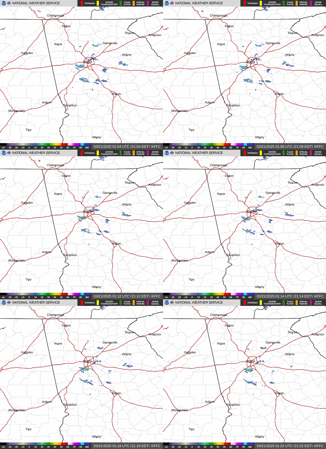
Source: National Weather Service radar, station KFFC. The loop is served live by the NWS and shows its own frame times.
Recent rain at the gauge location Official NWS
| Window and end time | Rain |
|---|---|
| Last 24 h, to Oct 16, 10:00 PM EDT | 0.00 in |
| Last 2 days, to Oct 16, 8:00 AM EDT | 0.00 in |
| Last 3 days, to Oct 16, 8:00 AM EDT | 0.00 in |
Source: NWS River Forecast Center multisensor precipitation estimate, 4 km grid at the gauge location, fetched Oct 16, 11:31 PM EDT. Estimate, not a gauge at the stream. Each window is a separate NWS product with its own end time (hourly and daily products), so a longer window can end earlier than a shorter one and show less rain.
Forecast rain totals Official NWS
| Window | Forecast rain |
|---|---|
| Next 6 hours | 0.00 in |
| Next 12 hours | 0.00 in |
| Next 24 hours | 0.00 in |
| Next 48 hours | 0.00 in |
| Next 72 hours | 0.00 in |
| Next 7 days | 0.00 in |
Source: National Weather Service gridpoint quantitative precipitation forecast at the gauge location, updated Oct 16, 2:27 PM EDT. A forecast, not a measurement.
Temperature and precipitation outlooks Official NWS
| Outlook | Period | Variable | Leaning | Probability |
|---|---|---|---|---|
| 8 to 14 day | Oct 24 to Oct 30 | Temperature | Above | 50% |
| 8 to 14 day | Oct 24 to Oct 30 | Precipitation | Below | 33% |
Source: NOAA Climate Prediction Center outlooks at the gauge location (8 to 14 day for Oct 24 to Oct 30), issued Oct 16. A probability is the chance of the leaning category (above, near or below normal) for the whole period, not an amount.
Hourly forecast, next 24 hours Official NWS
| 11p | Sat | 1a | 2a | 3a | 4a | 5a | 6a | 7a | 8a | 9a | 10a | 11a | 12p | 1p | 2p | 3p | 4p | 5p | 6p | 7p | 8p | 9p | 10p | |
|---|---|---|---|---|---|---|---|---|---|---|---|---|---|---|---|---|---|---|---|---|---|---|---|---|
| Temp °F | 60 | 57 | 55 | 54 | 53 | 52 | 50 | 50 | 49 | 49 | 50 | 53 | 56 | 59 | 62 | 63 | 65 | 64 | 63 | 62 | 59 | 55 | 53 | 52 |
| Wind mph | 18 | 18 | 16 | 16 | 15 | 16 | 16 | 16 | 16 | 15 | 16 | 17 | 16 | 16 | 16 | 16 | 17 | 17 | 15 | 15 | 13 | 12 | 10 | 8 |
| Gust mph | 33 | 32 | 30 | 29 | 29 | 28 | 28 | 28 | 26 | 25 | 26 | 28 | 26 | 28 | 28 | 28 | 28 | 28 | 25 | 24 | 23 | 22 | 21 | 17 |
| Direction | NW | NNW | NNW | NNW | NNW | NNW | NNW | NNW | NNW | NNW | NNW | N | N | N | N | N | N | N | N | N | N | N | N | N |
| Cloud % | 47 | 54 | 48 | 46 | 40 | 30 | 14 | 10 | 9 | 12 | 6 | 9 | 7 | 4 | 7 | 4 | 4 | 4 | 4 | 3 | 2 | 2 | 0 | 0 |
| Rain in/h | 0 | 0 | 0 | 0 | 0 | 0 | 0 | 0 | 0 | 0 | 0 | 0 | 0 | 0 | 0 | 0 | 0 | 0 | 0 | 0 | 0 | 0 | 0 | 0 |
| Rain chance % | 0 | 0 | 0 | 0 | 0 | 0 | 0 | 0 | 0 | 0 | 0 | 0 | 0 | 0 | 0 | 0 | 0 | 0 | 0 | 0 | 0 | 0 | 0 | 0 |
Source: National Weather Service gridpoint forecast, updated Oct 16, 2:27 PM EDT; rain chance from the NWS hourly point forecast. Hours are gauge-local. Darker cells mean a higher value in that row.
Weather forecast Official NWS
Source: National Weather Service point forecast, updated Oct 16, 2:27 PM EDT.
Air conditions Weather station
| Measure | Value |
|---|---|
| Air temperature | 60 °F |
| Gusts | 29 mph |
| Pressure | 30.07 inHg, rising |
| Visibility | 10 mi |
Source: National Weather Service station KMGE, observed Oct 16, 10:55 PM EDT.
Sun Computed
| Event | Time (gauge-local) |
|---|---|
| Sunrise | 7:44 AM EDT |
| Sunset | 7:04 PM EDT |
Source: computed from the gauge location and date 2026-10-16. No external data.
Sources and method
- Forecasts, alerts and observations: National Weather Service. NWS material is not subject to copyright. Terms
- Data: U.S. Geological Survey. Terms
- River forecasts, flood stages, crests and impact statements: National Weather Service. Terms
- Rain estimates and radar: NOAA and National Weather Service. Terms
- Outlook: NOAA Climate Prediction Center. Terms
USGS daily statistics, downloaded Oct 12, 2026
Percentile method: trailing 24 h mean vs USGS daily percentiles for calendar date 10-16.
Percentile is estimated from USGS published daily percentiles. Readings are provisional until USGS reviews them. Not endorsed by USGS, NOAA or the National Weather Service. Not for navigation or safety-of-life decisions; the absence of an alert is not a statement that conditions are safe.